

From the 9-1-1 call to coordinated response ~
one connected CAD platform.
SkyCAD brings call intake, resource recommendation, live unit location, mapping, dispatch workflow, and operational status into one real-time environment—giving public-safety teams the information they need to coordinate every response.
Real-time emergency response resource ETA through GPS + traffic data
CAD-2-CAD interfacing with Voice and Data
Automatic ETA based available resource recommendations
Cloud-based architecture with secure end-to-end encryption
Turn every call into a coordinated response.
Public safety rarely operates inside the boundaries of a single screen, department, or communications channel. An incident may involve multiple agencies, mobile resources, private service providers, and decisions that must be updated continuously as conditions change.
SkyCAD keeps critical information moving from call intake through incident closure—helping dispatchers, supervisors, and authorized personnel work from the same current information.
One environment, from the first ring to the final report.
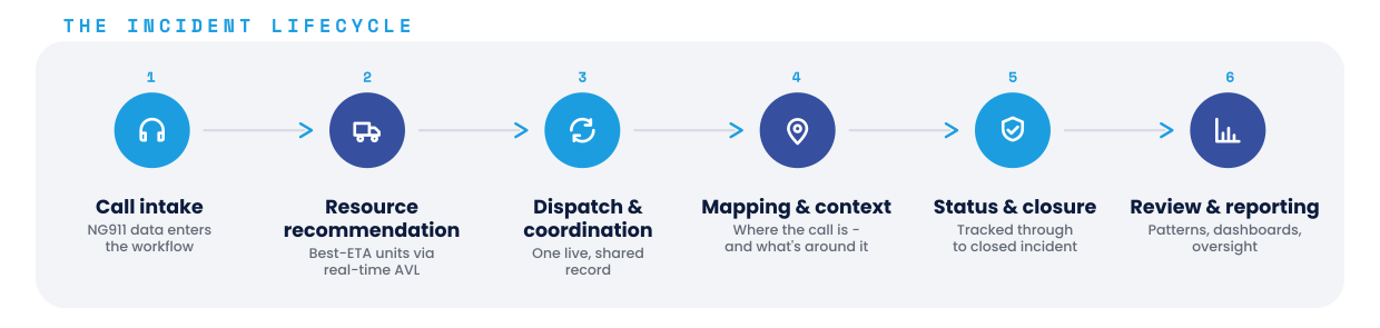
Every incident follows the same path in SkyCAD—call data comes in, the right units are recommended and dispatched, the field picture stays current on one shared record, and the whole event is closed out and available for review. No re-keying between systems, no gaps between steps.
Everything a dispatcher needs, in one real-time picture.
Six capabilities work together inside a single dispatch environment:
SkyCAD receives supported NG911 call data and brings it directly into the dispatch workflow, reducing duplicate entry and unnecessary handoffs between call handling and dispatch operations.
Live AVL information helps dispatchers identify the best-ETA available resources based on current location and operational status—not assumptions or outdated information.
Calls for service, assignments, unit status, and response activity update across authorized screens as the incident develops, so everyone involved operates from a consistent record.
SkyCAD combines incident locations, unit positions, and relevant GIS information so personnel understand not only where the call is, but what surrounds it.
Police, fire, EMS, emergency management, city resources, and supported private response providers can be managed within a more unified operational workflow.
Dashboards, historical reporting, activity thresholds, and supervisor notifications help agencies identify patterns, review performance, and maintain greater awareness of system activity.
Proven where coordination is most challenging.
SkyCAD is more than a departmental CAD installation. It has been deployed across 77 of Puerto Rico’s 78 jurisdictions, supporting a complex US public-safety environment made up of independently administered municipalities, multiple agency types, and an extensive private ambulance network. That experience matters to any city, county, regional authority, or communications center that must coordinate resources beyond a single department.
77 of 78
Puerto Rico jurisdictions
using SkyCAD
140+
Private ambulance providers connected
Police • Fire • EMS
Multiple public-safety disciplines
EN + ES
Bilingual operational capability
Puerto Rico’s public-safety structure presents the same coordination challenges found in many continental US markets: independently managed agencies, jurisdictional boundaries, public and private response resources, and incidents that don’t stay neatly within one organizational structure. SkyCAD’s broad deployment demonstrates experience adapting one proven CAD platform to many operational environments—not simply installing the same configuration repeatedly.
One dispatch core. A platform that can grow with you.
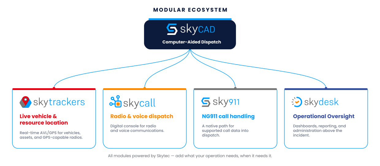
An agency may begin with SkyCAD as its Computer-Aided Dispatch foundation and expand the environment over time as operational requirements evolve. The Skytec ecosystem adds specialized capabilities without requiring every component to be implemented at once.
SkyCAD is RapidSOS Ready.
Dispatchers get enhanced, real-time device and location data from connected 9-1-1 callers directly within the dispatch environment—an added layer of caller intelligence that strengthens situational awareness and helps teams locate and respond to emergencies faster.
See SkyCAD in Action.
Stay in the loop
Share your contact info to stay up-to-date on our software solutions' evolution and industry information that may help achieve your objectives.

500 CARR 869
STE 501
Cataño, PR 00962-2011
• • • • • • • • • • • • • • • • •